Ascent – 1824 ft.
Descent – 1808 ft.
Min Elevation – 5152 ft.
Max Elevation – 6813 ft.
High Resolution Topo Maps
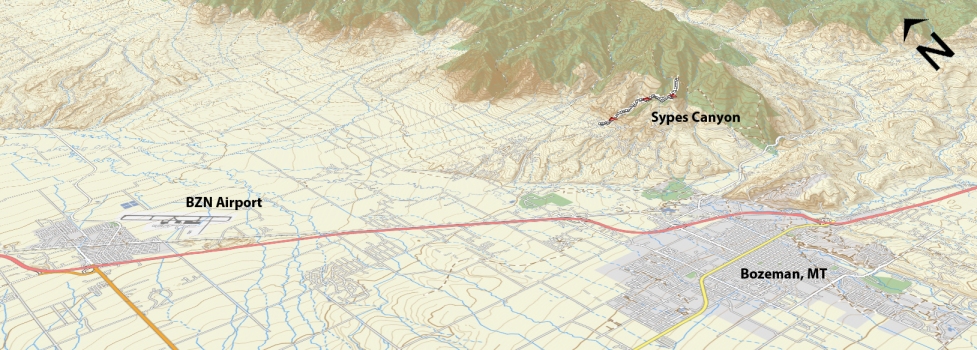
Nestled two drainages north of the famous hiking trail which leads to the College M on the hillside overlooking Bozeman, Sypes is accessed from Springhill road and is traveled by more hikers than riders but don’t let that deter you from riding this trail. The parking at the trailhead is limited but there is overflow parking just down the road where it turns to dirt (typically a better place to park to give your legs a brief warmup). This trail is known for its initial ruthless climb that will have all but the strongest riders walking to the top. On the bright side, the climb is short and over in just a ½ mile. As you descend back into the trees and make your way up the
 valley of the canyon you will encounter some technical sections that are yet again walked by most but this time it is only 15 feet here and 30 feet there. Once you are past the jagged rock outcropping with an exposed edge and the rock peppered mini climb shortly after the trail still maintains its grade but the technical difficulty drops and it is now just a game of balancing your legs and lungs. Once you climb out of the canyon you will end up at an intersection (2 mile mark) where the trail goes either left or right. Go Left (the trail to the right goes up the hill but dead ends shortly after the top) and continue climbing along the ridgeline. The trail will become more technically challenging than the majority of initial climb but not as technical as the few sections after the first climb. The views of Bozeman are great as you approach the top (2 ½ mile mark). The final climb to the summit of Sypes is a brutal one and requires a section of hike-a-bike. Many people stop short of the summit and turn around at the 2 ¼ mark due to the highly technical nature of the last ¼ mile of the ride.
Time Share Trail – More information on timeshare click here.
The trail is open to mountain bikers with timeshare restrictions from June 16th – September 4.
Driving Directions:
From Bozeman, drive north on 7th over the highway and continue onto the frontage road. Continue on the frontage road and take a right at the first light (Springhill Rd) right on Springhill road. Drive .2 miles then turn right on Sypes Canyon Rd., continuing until the end of the Y at the end of the road; bear right and park at the signed trailhead (6 spots). Overflow parking is available on the right before the final turn to the trailhead (12 spots).
Google Maps Driving Directions (IOS and Android compatible)
Sypes Canyon Trailheads


