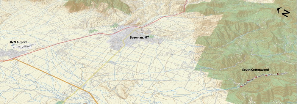
Ascent – 1248 ft.
Descent – 1252 ft.
Min Elevation – 5719 ft.
Max Elevation – 6309 ft.
High Resolution Topo Maps
 Now here is a trail for the masses! Great for the beginner and intermediate alike who are starting to get the itch of singletrack rides but still at a level where confidence is being built daily. It is not a true ‘singletrack’ but it does give off the impression. This trail is also great for those more experienced riders looking for a fun ride with some technical sections here and there along the trail. One of the most difficult sections of this trail is the initial climb from the trailhead. It is short and sweet but will not doubt get your legs burning and lungs pumping. Once you have reached to top of the first climb (.40 miles) the trail mellows out on incline and starts to weave its way up the canyon towards Blackmore in the distance. You will have to cross a few bridges throughout the ride but they are well maintained by the forest service. If you decide to venture much beyond the third bridge (Wheeler Gulch trailhead is about a hundred yards up the trail, on the right) the terrain will change quickly from an intermediate trail at that point, to a difficult trail with steep climbs, rock and root drops, and ask a little more from the rider. Once you cross the fourth bridge you will ride through some beautiful meadows stuck between the steep hill faces on either side as you continue towards fox cabin and the intersection for History Rock and Blackmore.
Driving Directions:
Departing from Bozeman, drive west on Main Street and take a left (south) on 19th. Continue to drive on 19th Street headed south and west out of town. Take S. 19th out past Hyalite to the intersection with Cottonwood Rd. Turn left and wind through a big right bend before taking another left Cottonwood Canyon Rd. From there, it’s about 2 miles to the trailhead at the end of the road (please watch your speed (25 MPH) and the residents will love you for it!)
Google Maps Driving Directions (IOS and Android compatible)
South Cottonwood Trailhead


