Ascent – 1424 ft.
Descent – 1425 ft.
Min Elevation – 5729 ft.
Max Elevation – 6881 ft.
High Resolution Topo Maps
Here is a trail that is loved by many locals for its ease of access, lung sucking climb, along with a well-manicured, screaming fast fun downhill. Leverich is a directional trail giving way to an uninterrupted uphill and downhill. There are three parking areas but the upper is the only official parking lot at the base of the trailhead. Most riders choose to park about halfway up the dirt road to the upper lot, giving the rider an opportunity to get the legs and lungs working. Right from the trailhead the trail is merciless and will have you searching for your easier gears in a hurry. About 200 yards up the trail you come to a fork in the trail, take the route to the left (recommended uphill direction), continue climbing for about a 1 ¼ miles and you will be greeted with a short but fun downhill section ending at an old mine shaft. Continuing past the mine shaft it will be uphill till you reach the top. Shortly after leaving the comfort of the short downhill you will be met by two technical sections, the first being very short and sweet
and the second putting the rider to the test of strength and endurance. At the 2 ½ mile mark you will come to an intersection (left towards Moser Creek, right towards the top of Leverich), go right and finish out the last section of uphill. Take a breather at the top and prepare yourself for a fast and fun downhill. There are a few technical sections on the downhill, so be on the lookout for them if it is your first time riding this trail. Once you return to the lower intersection, please keep your speed down, there will most likely be uphill traffic, and that section is mostly blind for the rider coming downhill.
Driving Directions:
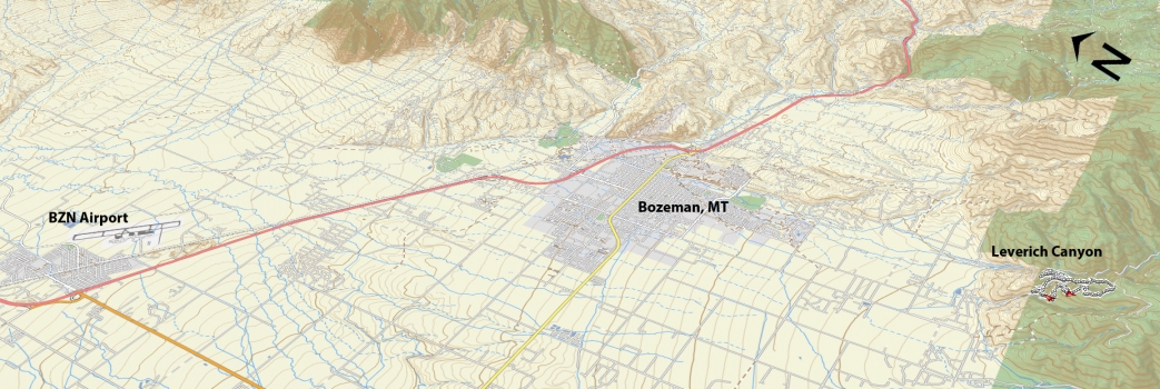
Departing from Bozeman, drive west on Main Street and take a left (south) on 19th. Continue to drive on 19th Street headed south for 5 miles to Nash Rd. Turn left and drive 0.4 miles to S. 3rd Ave. Turn right and continue to the end of the pavement. The lower parking area is ½ mile after the pavement ends. The upper lot is another ½ mile beyond the lower parking area. At ¾ miles after the pavement ending the road becomes steep and sometimes can have deep potholes that can make driving up difficult; if this is the case there is a small pullout area (enough for one, maybe two vehicles) and ride the remaining 0.2 miles up the road.
Google Maps Driving Directions (IOS and Android compatible)
Leverich Canyon Trailheads


