Trail Difficulty – Intermediate
Trail Length – 7.50 miles
Trail Time Share – No
Ride Type: Out & Back
Ascent – 1577 ft.
Descent – 1643 ft.
Min Elevation – 6070 ft.
Max Elevation – 7408 ft.
High Resolution Topo Maps
You start out riding a logging road closed to vehicles but open to ATV’s and motorcycles for approximately 1.5 miles. It offers a chance to let your lungs and legs sync with one another before the grade slightly steepens. You will come to a wide single track on your right and this will take you up towards Bear Canyon / Chestnut Mountain intersection. Once you
 arrive at the intersection; It is just a single 5 inch in diameter wooden post near the end of the first meadow you ride through. Pay attention for this post, for if you miss it you will have a VERY steep climb back up to where you started. At the post take a sharp right and continue uphill along the ridge line towards Chestnut Mountain. Seemly endless fields of wildflowers will surround you as you pick your way up the single track. This is a great out and back or full loop trail when connected to Goose Creek to Chestnut Mountain trail. The summit is somewhat tricky to decipher, as there are a few rolling ups and downs at you approach the top.
Driving Directions:
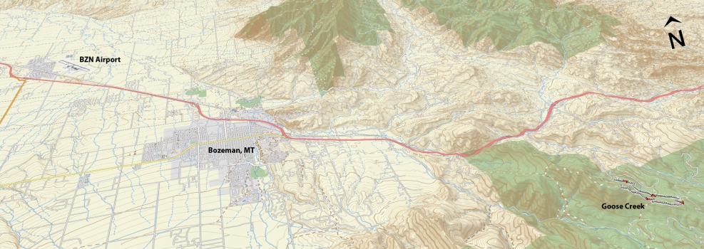
From Bozeman, drive east on I-90 towards Bozeman Pass. Take the Trail Creek exit (Exit 316) and turn right over the train tracks (headed south on Trail Creek Rd). Head south on Trail Creek road for 3 miles to the well-marked road heading up Goose Creek (on the right). Follow this road for 1 mile and bear right at the “Y” in the road and continue through private property for approximately another mile until you reach the locked gate and parking area. Be respectful of private property and stay on the main road while you are driving up to the trailhead.
Google Maps Driving Directions (IOS and Android compatible)
Goose Creek Trailhead


