Trail Difficulty – Intermediate
Trail Length – 7.05 miles
Trail Time Share – No
Ride Type: Loop / Shuttle
Ascent – 947 ft.
Descent – 2295 ft.
Min Elevation – 5797 ft.
Max Elevation – 7415 ft.
High Resolution Topo Maps
Here is a trail for the masses! This is very popular group ride every summer! Short and sweet uphill that ends with incredible views of the surrounding mountain ranges and a downhill that has something to offer for every ability level. This is the last section of the Bangtail Divide Trail which starts at the top of Olsen Creek road (parking area about 300 yards from the trailhead). Start by driving past Olsen Creek road and dropping off one
 vehicle at the Bracket Creek Trailhead and then drive back to the turnoff for Olsen Creek Road and drive to the top to the parking area (stay left where the road splits). The trail jumps right into a flowy single track that gets your adrenaline pumping and stoke level soaring. As the short downhill comes to an end the trail will start to roll through dense forest and open up into a small but quaint high mountain meadow as you begin your ascent towards to top. There are a few technical sections on the uphill that will test your bike handling skills and remind you that this is not walk in the park but rather a mountain bike adventure! Once the you reach the summit take a minute to hike up to the rock outcropping on your right (looking east) and take in the great views. It is all downhill from here and time to enjoy the ride! Pay attention to others riding up and remember to give them the right-a-way (it’s a hard climb so help them out!)
Driving Directions:
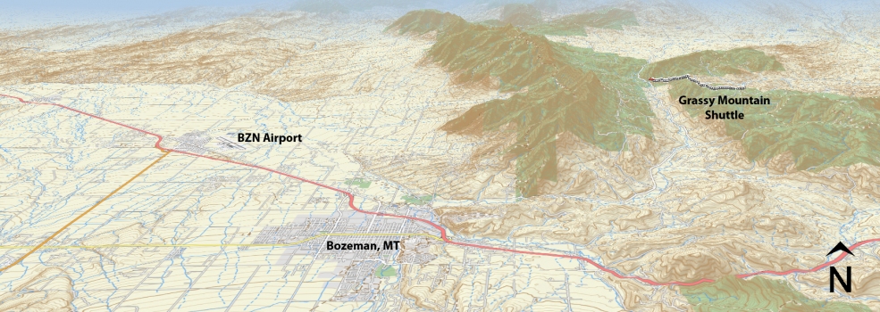
From Main Street in the center of Bozeman take Rouse St. north following signs toward Bridger Bowl Ski Area. Rouse turns into Bridger Canyon Road (Highway 86), continue to drive northeast up Bridger Canyon approximately 18 miles. Turn right at Brackett Creek road, the parking lot for the trailhead is on the right just after turning off Bridger Canyon road. If you are planning on using two vehicles to shuttle this ride, leave your first vehicle here. Drive back towards town for approximately 5 miles and turn left on Olsen Creek Road. Drive 4.3 miles (bear left at the junction near the top of the road around 4 miles) and park on the left side about 300 yards after the junction. From here continue to ride east on the logging road and you will see a single track going across the road about 300 yards up from the parking area. Turn Left (north) on the single track and this is the beginning of the trail.
Google Maps Driving Directions (IOS and Android compatible)
Grassy Mountain Trailhead
Brackett Creek Trailhead


