Ascent – 2589 ft.
Descent – 2591 ft.
Min Elevation – 5272 ft.
Max Elevation – 7491 ft.
High Resolution Topo Maps
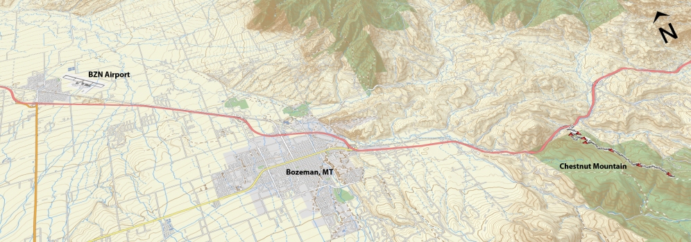
This is a great trail that takes you through some great dense forest areas with tall foliage. Leaving the parking lot you will be greeted with a stiff climb for almost a mile where you will have a brief reprieve before the trail will continue its relentless climb towards the summit. This is a nicely cut single track from bottom to top. The views from the top of Chestnut Mountain are amazing; you can see Bozeman below in the valley looking west or a great view of the Crazy Mountain range off in the distance to the east. Watch your speed on the descent, many of the corners come much quicker than expected and can potentially throw you into the surrounding forest.
Driving Directions:
From Bozeman, drive east on I-90 towards Bozeman Pass. Take the Trail Creek exit (Exit 316) and turn right over the train tracks (headed south on Trail Creek Rd). The Trailhead parking is on the south side of the road, approximately ⅛ mile from the interstate exit.
Google Maps Driving Directions (IOS and Android compatible)
Chestnut Mountain Trailhead


