Trail Difficulty – Intermediate
Trail Length – 8.0 miles
Trail Time Share – No
Ride Type: Out & Back
Ascent – 2210 ft.
Descent – 2209 ft.
Min Elevation – 5792 ft.
Max Elevation – 7415 ft.
High Resolution Topo Maps
This trail is the last section of the Bangtail Divide Trail which ends with a 4 mile downhill that will have you smiling ear  to ear. With that being said, you have your fair share of uphill, but it is completely worth it on the return trip. This trail begins with steep tight switchbacks that get you up and around the first ridgeline. You will continue along the northern bangtails for another mile and then continue riding up with multiple tight switchbacks, sprinkled with rocks and loose material. You will find yourself encountering a broad range of trail conditions from smooth rolling areas to very rocky inclines and everything in the middle. As you climb higher into the
 bangtails some great views will present themselves of the Bridger Range to the west, and even the opportunity to see Bridger Bowl Ski Area from across the valley near the top of the trail. You will encounter a steep rocky section about 3 ¼ miles up that will test your bike skills and endurance. The summit of Grassy Mountain just a little over 4 miles up. This is the same summit for incredible views as if you were to ride Grassy Mountain Shuttle! Take a minute to hike up to your left (east) and soak up the incredible views. Fuel up and rehydrate for the return downhill!
Driving Directions:
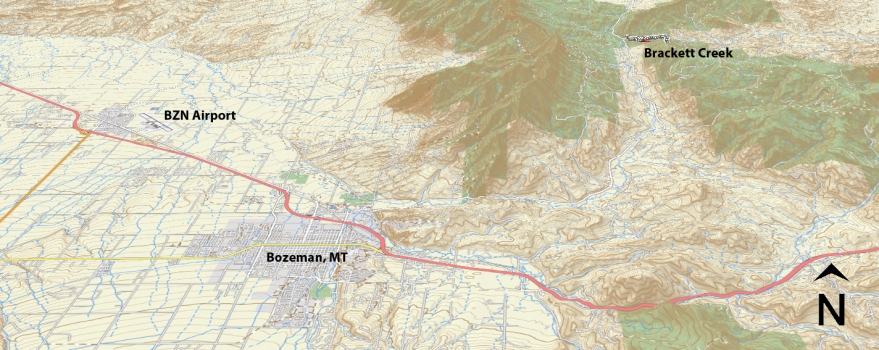
From Main Street in the center of Bozeman take Rouse St. north following signs toward Bridger Bowl Ski Area. Rouse turns into Bridger Canyon Road (Highway 86), continue to drive northeast up Bridger Canyon approximately 18 miles. Turn right at Brackett Creek road, the parking lot for the trailhead is on the right just after turning off Bridger Canyon road.
Google Maps Driving Directions (IOS and Android compatible)
Brackett Creek


