Ascent – 2317 ft.
Descent – 2379 ft.
Min Elevation – 5681 ft.
Max Elevation – 7656 ft.
High Resolution Topo Maps
 This is typically the start point if you were planning on riding the Bangtail Divide Trail. If you are one who loves switchbacks then this is the trail for you! Well at least the lower section boosts 23 switchbacks in the first 1 ½ miles. The nice part of the switchbacks is that all can be ridden by a rider with intermediate to strong intermediate bike handling skills. As the trail continues up the mountain side you will encounter fewer switchbacks and farther apart. The
 trail becomes fun and flowy as you enter the upper section on your way to the summit. The views are limited during your ascent but you will be rewarded with 360 degree views of all the surrounding mountain ranges at the top. At the top the trees fade away and you will find yourself riding next to an old barb wire fence. This is the que to take a break, snap a few images, and prepare for the fun downhill!
Driving Directions:
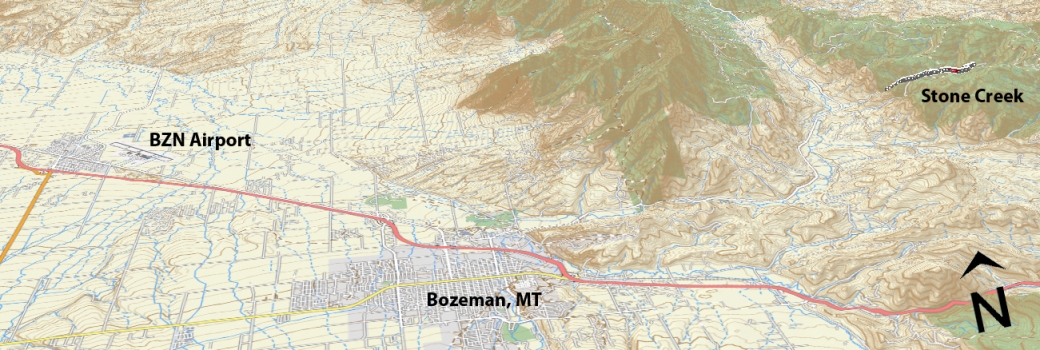
From Main Street in the center of Bozeman take Rouse St. north following signs toward Bridger Bowl Ski Area. Rouse turns into Bridger Canyon Road (highway 86). Continue north for approximately 11 miles. Turn right on Stone Creek Road (a dirt road). Follow that road to large parking area (left side) where road is gated. The trail takes off the south side of road just before gate.
Google Maps Driving Directions (IOS and Android compatible)
Stone Creek Trailhead


